Skip to content
partrac logo
+44 (0) 1626 906 673
  • V-LiDAR
  • Services
        • Metocean
          • Offshore Metocean Measurement
          • Offshore Wind Resource Measurements (Floating Lidar)
          • Coastal Oceanography
          • Dredging & Port Construction Monitoring
          • Metocean Design Criteria
          • Metocean Analysis & Consultancy
          • Numerical Modelling
          • Survey Scoping & Management
          • Site Feasibility Studies
        • Seabed & Hydrodynamics
          • Marine Environmental Impact Assessments (EIA)
          • Numerical Modelling
          • Seabed Level Variability Prediction
          • Engineering Design and Certification Support
          • Cable Burial, Foundation Scour and Landfall Assessment
          • Expert Witness
          • Survey Scoping & Management
  • Sectors
    • Offshore Wind
    • Cables & Pipelines
    • Ports, Harbours & Dredging
    • Coastal Industries & Outfalls
    • Marine Renewables
    • Aquaculture
  • Projects
    • Key Projects
    • Our Clients
  • About Us
    • QHSE
    • Our Story
    • Meet The Team
    • Contact
  • Careers
  • News
  • V-LiDAR
  • Services
    • Metocean
      • Offshore Metocean Measurement
      • Offshore Wind Resource Measurements (Floating Lidar)
      • Coastal Oceanography
      • Dredging & Port Construction Monitoring
      • Metocean Design Criteria
      • Metocean Analysis & Consultancy
      • Numerical Modelling
      • Survey Scoping & Management
      • Site Feasibility Studies
    • Seabed & Hydrodynamics
      • Marine Environmental Impact Assessments (EIA)
      • Numerical Modelling
      • Seabed Level Variability Prediction
      • Engineering Design and Certification Support
      • Cable Burial, Foundation Scour and Landfall Assessment
      • Expert Witness
      • Survey Scoping & Management
  • Sectors
    • Offshore Wind
    • Cables & Pipelines
    • Ports, Harbours & Dredging
    • Coastal Industries & Outfalls
    • Marine Renewables
    • Aquaculture
  • Projects
    • Key Projects
    • Our Clients
  • About Us
    • QHSE
    • Our Story
    • Meet The Team
    • Contact
  • Careers
  • News

Floating LiDAR

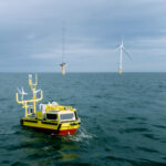
Venterra Launches V-LiDAR: £10 Million UK Investment Delivers Global Fleet of Dual Hi-Tech Lidar Buoys for Offshore Wind

October 22, 2025 by Michelle Kelleher

Venterra Group, the offshore wind services champion, announces the launch of the Venterra V-LiDAR – a global fleet of state-of-the-art dual LiDAR buoys, a testament to … Read more
Categories Partrac News Tags Floating LiDAR, metocean
partrac logo
+44 (0) 1626 906 673
  • Registered Office: 4th Floor, 115 George Street, Edinburgh, EH2 4JN, UK. Company Registration No: SC253856, Registered: Scotland.
  • Copyright © 2025 Partrac
  • Privacy & Cookie Policy
Contact us